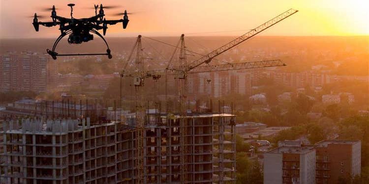
In recent years, the adoption of drones, or UAVs, has played a crucial role in precision mapping, land surveying, and geospatial data collection. UAVs have emerged as cost-effective and efficient alternatives to traditional methods in sectors such as urban planning, agriculture, environmental monitoring, and disaster management.
Simultaneously, the geospatial analytics market is experiencing significant growth, with projections indicating a strong upward trajectory in 2025. Estimates vary, with Straits Research forecasting a market size of USD 93.91 billion, while The Business Research Company predicts USD 104.4 billion at a compound annual growth rate (CAGR) of 13.5%. These variations underscore the rapid advancements and increasing adoption of geospatial analytics across multiple industries.
This blog post, the first in a series, explores the role of UAVs in the Architecture, Engineering, and Construction (AEC) industry. It covers the various components of UAVs , advancements in the AEC industry, and their geospatial applications in disaster management. Additionally, we’ll touch upon how the integration of UAVs with edge computing is transforming the industry, a topic that will be discussed in the next blog post.
Significant Use Cases:
The AEC industry, driven by the need for unprecedented efficiency and precision in project management, is now the second-largest market for drones. Key applications include:
- 3D Mapping: Drones create precise models of real-world environments, improving planning, progress tracking, and inspections. Equipped with photogrammetry or LiDAR, they generate accurate Digital Elevation Models (DEMs) and Digital Surface Models (DSMs) for Building Information Modeling (BIM).
- Real-Time Tracking: Drone data offers real-time progress monitoring, ensuring alignment between as-planned and as-built projects. This minimizes delays and reduces costs by identifying errors early.
- Construction Site Communication and Safety: Drones enhance communication among stakeholders by up to 65% and improve safety through remote inspections in hazardous areas.
Drones in Construction and Engineering
-
Construction of Buildings
Drones facilitate tasks such as erecting new structures, modifying existing buildings, and maintaining or repairing damaged ones. Combined with BIM software, drones create digital twins of buildings by capturing data from all angles. This data provides 3D models and aerial imagery, which ultimately helps improve planning, resource allocation, and decision-making.
-
Civil Engineering Construction
-
Highways, Bridges, and Dams:
Drones inspect topography, analyze land suitability, and identify potential hazard zones and terrain conditions. They reduce inspection downtime by providing aerial data without intensive ground verification.
-
Hydropower Plants:
UAVs capture water flow data using elevation models, inspect turbines for damage, and detect structural issues such as cracks or erosion.
-
-
Energy Sector and Infrastructure Monitoring
- Power Inspections: Drones ensure the normal operation of power stations and transmission lines by remotely analyzing faults.
- Wind Turbine Inspections: UAVs offer safer, faster, and more detailed inspections, identifying hidden damage to optimize maintenance schedules.
- Solar Farm Inspections: Equipped with thermal cameras, drones detect defects and improve energy production 50 times faster than traditional methods.
-
Smart Cities
UAVs play an essential role in urban planning, environmental monitoring, and public safety, contributing to environmental conservation and sustainability.
Role of UAVs in Emergency Response in the AEC industry:
Drones are critical in various stages of emergency response:
- Preparedness: UAVs enable mapping and monitoring of potential disaster hotspots, support evacuation route planning, and assist in setting up temporary facilities.
- Response: Drones are utilized for 3D mapping, search and rescue operations, and re-establishing communication networks on construction sites.
- Recovery: They aid in damage assessment for repairs and insurance claims, as well as delivering essential supplies such as food, water, and medicine.
Specific disaster applications include:
-
Earthquakes:
Rapid damage mapping and survivor detection using thermal imaging.
-
Floods:
Real-time monitoring, evacuation planning, and supply delivery.
-
Forest Fires:
Early detection of hotspots and aerial monitoring of fire spread.
Rapid Damage Assessment
Equipped with high-resolution cameras, drones can quickly survey large areas of affected infrastructure, capturing detailed imagery of damaged buildings, bridges, roads, power lines, and other critical structures, during the construction phase enabling quick evaluation of the extent of damage and assessing the impact.
Drones can cover large areas rapidly, providing a comprehensive view of the disaster zone.
-
Real-time Data:
Drones provide immediate visual information, enabling quick response and decision-making during emergencies.
-
Search and Rescue Operations:
Drones can access hazardous or hard-to-reach areas, such as collapsed buildings or steep terrain. Thermal imaging cameras detect heat signatures of trapped individuals, improving rescue efficiency.
-
Flood Monitoring:
Drones track flood levels and movements in real-time, providing data crucial for evacuation planning and resource allocation.
-
Landslide Detection:
Aerial imagery helps identify potential landslides by analyzing terrain changes, enabling preventative measures.
-
Post-Disaster Reconstruction Planning:
Detailed 3D models generated from drone data assist in creating accurate maps for efficient reconstruction planning.
UAVs and Their Growing Impact:
The future of UAVs is promising, with advancements in safety, speed, control accuracy, and measurement precision. Drones are revolutionizing industries by collecting data efficiently and safely, proving to be a pivotal advancement for the AEC industry and beyond.
- Edge Computing: This distributed computing paradigm processes data closer to where it is needed, reducing latency and bandwidth usage. By combining AI algorithms with edge computing, UAVs can perform sophisticated data analysis, predictive modeling, and autonomous decision-making, enhancing their capabilities in project planning, execution, and monitoring.
- Enhanced Sensor Technology: In 2024, UAVs are equipped with high-resolution cameras, LiDARsensors, multispectral and hyperspectral imaging sensors, and thermal cameras.
- Improved Data Processing and Analysis: Advanced algorithms allow UAVs to analyze data in real time, facilitating immediate decision-making and reducing interpretation time.
Expectations of End Users:
Advancements in drone technology and geospatial applications enhance operational efficiency, empowering users across industries to leverage precise, timely data for better decision-making. These innovations foster safety, sustainability, and innovation, ensuring that drones remain indispensable tools in modern geospatial practices.