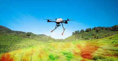
Vegetation monitoring has evolved from manual field observations to continuous, satellitedriven
intelligence powered by geospatial analytics. Among the various spectral indices
supporting this transformation, the Normalized Difference Vegetation Index (NDVI) has
emerged as one of the most widely adopted indicators for assessing vegetation variability
across agriculture, environmental monitoring, and infrastructure domains.
Despite its widespread use, NDVI is often misunderstood in enterprise implementations.
NDVI is not a decision metric; it is a proxy indicator that reflects vegetation vigor based on
spectral response. Its value lies not in isolation, but in how it is integrated, contextualized, and
operationalized within broader geospatial systems.
As enterprise GIS ecosystems continue to evolve, NDVI is increasingly embedded within
architectures that combine satellite imagery, terrain data, weather information, AI-driven
analytics, and operational workflows. This transition is transforming NDVI from a visualization
layer into a scalable spatial intelligence capability that supports proactive monitoring, risk
management, and enterprise decision-making across utilities, infrastructure, environmental
monitoring, and sustainability programs.